The (unused) potential of drone inspection data

Twinsity GmbH receives Distr@l funding for an AI research project from the Hessian Ministry for Digital Strategy and Development
29. April 2022
GeoZICHT allows bridge inspections to be completed in less time and far more accurate
21. Juni 2022Over the past 15 years, the construction industry has experienced a boom in the use of drones. Complex scaffolding, cranes, and dangerous climbing maneuvers — the traditional tools of structural inspection — are no longer a necessity thanks to the technology.
Yet despite making inspections safer and more efficient, drone surveyance and data collection has one disadvantage: Drone surveys generate huge amounts of data, saddling surveyors with thousands of images which must be reviewed individually in a time-consuming manner. A process that is often unreliable.
The manual review process of images means the data can’t be used to its full extent. After all, an efficient and comprehensive inspection involves more than just the individual image; but important information on the area surrounding any weakness or damage, its exact location and the various perspectives of the location in question.
At present, photogrammetry technology is used to reconstruct drone data as a 3D model. This method has the advantage of visualizing the entirety of the object inspected, providing a better overview. But the exclusive use of the 3D modelling has one disadvantage: Most software cannot display these digital replicas in high resolution. Poor quality of the visualization paired with insufficient information can result in inadequate analysis, since any damage can’t be identified with certainty. The same applies to the conversion of the drone data into point clouds, these provide minimal insights into the object in question, just like the plain 3D model.
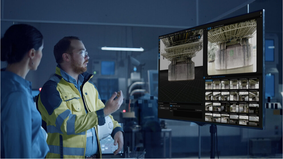
Twinsity’s new digital inspection platform TWINSPECTÒ eliminates these weaknesses. The innovative combination of a intuitive 3D model, a “digital twin”, and an original image database enables maximum efficiency in the inspection workflow.
With the help of the 3D model, the original images can be intelligently filtered so that a damage can be inspected from different perspectives and no relevant area is missed. When an engineer identifies damage TWINSPECT filters out the data needed for the inspection, so they can focus on what’s really important, rather than having to spending time working through countless unsorted images.
The inspection data is presented in an uncomplicated format, on one platform for all parties involved in the project — whether for the asset owner, client, or the responsible inspectors. TWINSPECTÒ is the hub for all project information, so inspection, analysis, communication, and documentation happen in one place.
Sharing the results is also easier, as the cloud-based software allows everyone involved to access the data from anywhere at any time. To fully integrate the drone inspection data into the inspection workflow, several helpful inspection tools are available to allow annotations, as well as millimeter-level measurements, on the original images and the 3D model. Various automations facilitate the work of the engineers: whether it is filtering the images or an automatically generated inspection report that provides all relevant information.
With TWINSPECTÒ, assets become sustainably safer — through increased data quality and more efficient documentation of damage and areas that may become defective. All parties involved in an inspection project come together in one digital place to work together on a new level. To get the most out of an inspection, Twinsity unleashes the power of drone inspection data.


