Your path to a faster and smarter inspection process with Twinspect

Fields of application: Infrastructure Inspections
31. March 2023
EIC ACCELERATOR PROGRAMME: €2.5 MILLION GRANT FOR TWINSITY
5. July 2023
Generating and processing the data
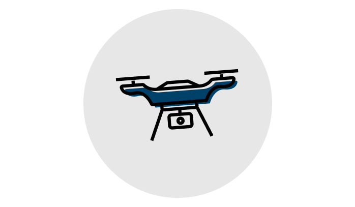
First, a large number of images of the object of interest must be captured, which is often done with a drone. Then, these images are converted into 3D models using reconstruction software. Twinsity supports leading photogrammetry solutions, including Agisoft Metashape, Bentley ContextCapture, RealityCapture, Pix4D and DJI Terra.
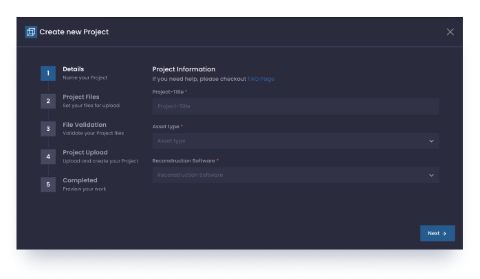
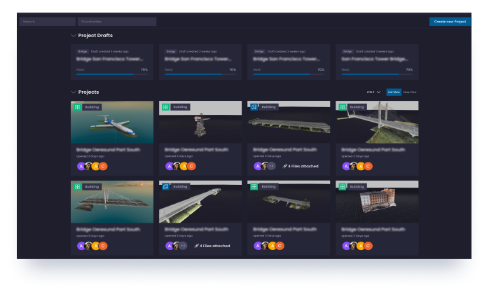
Upload
Next, the images, models, and camera metafiles are uploaded to Twinspect. This is easily done with a few clicks through your Twinspect account. You can find detailed step-by-step instructions on our FAQ page. After successful upload, both the model and the original images can now be viewed in Twinspect.
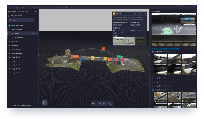
Inspect
You will now find the completed model with the associated images in your dashboard and the inspection can begin. Intelligently linked images to the corresponding point in the 3D model makes your inspection even faster. Any surveying and marking tools can now be used with ease.
Share and communicate faster
Because Twinspect is a web application, data and analysis can be easily shared with staff and clients. No manual reporting anymore: with Twinsity, experts get powerful reporting functionality to generate norm-compliant and custom inspection reports in various file formats.
Documentation and archiving
In order to also be able to guarantee attributes such as better security, better collaboration, more flexibility and automation when it comes to data backup and archiving, all of our data is backed up and protected via the cloud computing provider AWS.

Get in Contact with Twinsity


